HISTORY
MINING HISTORY
MINING HISTORY
No. 2 MINE
by Gail Hussey-Weir
Created October 2019; updated January 2023
by Gail Hussey-Weir
Created October 2019; updated January 2023
This page features pictures and brief descriptions of No. 2 Mine, the plant for which was located on the west side of Compressor Hill between The Green and No. 2 Road. In 1920, a young journalist named Joseph R. Smallwood, who would one day lead Newfoundland into Confederation with Canada, visited Bell Island for the first time to gather material for a series of articles for the Evening Telegram newspaper. He toured No. 2 Slope, which was nearly a mile long at the time, and remarked that walking back up the 15-degree slope reminded him of walking up Blackhead Road, a long, steep hill in St. John's. No. 2 Mine ceased operation in January 1950. The Bell Island Community Museum, which offers daily tours of the land area of No. 2 slope, occupies the area of the No. 2 Mine Yard where the collar of the mine was originally located.
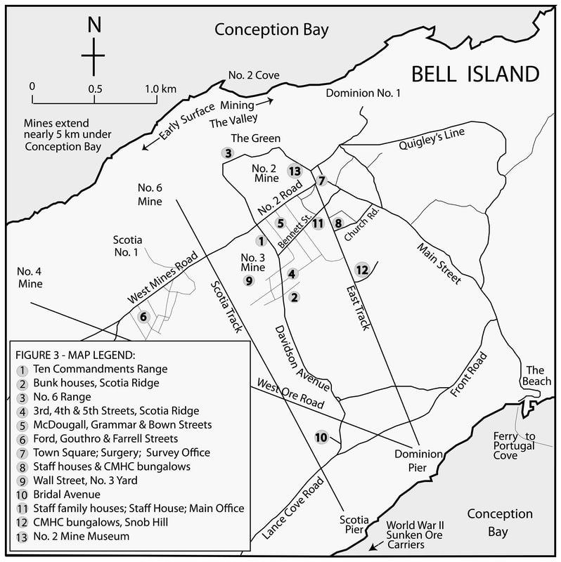
The map below shows the location of the plants for the four submarine mines, No. 2, No. 3, No. 4 and No. 6. No. 2 Mine Yard is seen at point 13, the northern terminus of East Track.
The map below shows the location of the plants for the four submarine mines, No. 2, No. 3, No. 4 and No. 6. No. 2 Mine Yard is seen at point 13, the northern terminus of East Track.
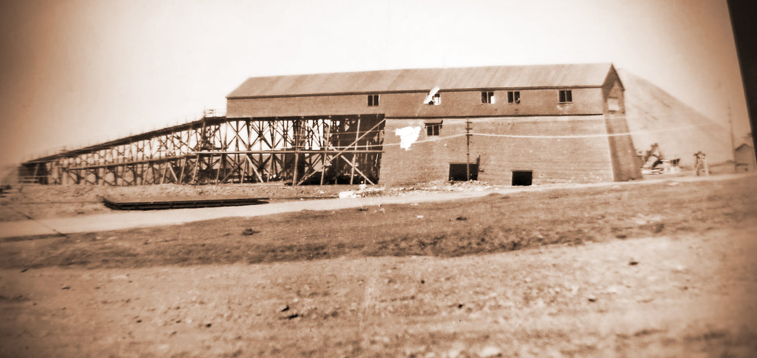
The photo above, courtesy of Jenn Ryan, is of No. 2 Deckhead, c. 1940s, looking from the west. Below is the No. 2 Deckhead as seen looking south from The Green, c.1940s, photo courtesy of Terry Dyer.
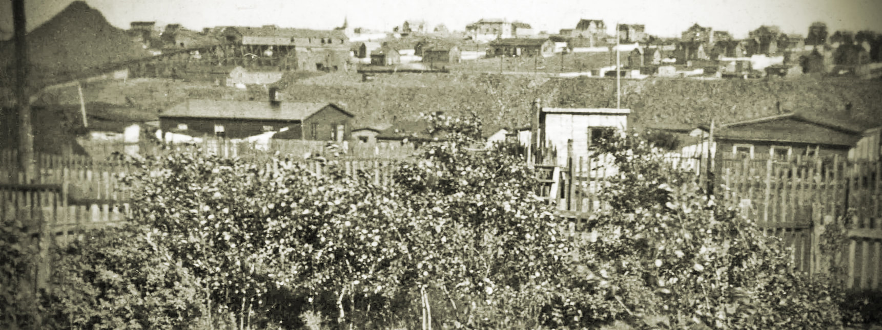
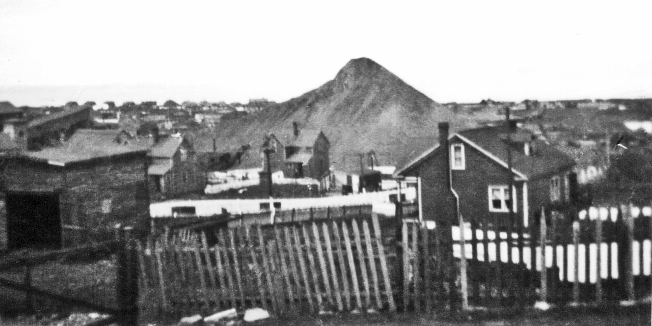
The photo below was taken from Bennett Street, a few doors east of the intersection with what was then the Dominion East Tramway, aka, East Track (now Steve Neary Blvd.), looking NW with The Green on the horizon. The "Slag Pile" in the center background is in No. 2 Mine Yard. The inclined building on the far left is part of No. 2 Mine infrastructure. No. 2 Submarine Mine was closed down in January 1950. Three of the one-ton ore cars that ran from No. 2 Mine to Dominion Pier can be seen in the center of the photo outlined against the white-washed picket fence, so the photo was taken sometime before 1950. Photo courtesy of A&SC, MUN Library, COLL-202.
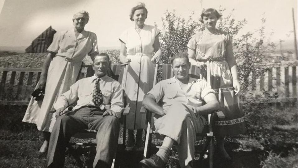
The photo below is of members of the Cole Family of No. 2 Road with the No. 2 Deckhead in the left background. No. 2 Mine was closed in January 1950. It is not known when the deckhead was dismantled. Photo courtesy of Gerry Cole. Seated L-R: James Cole and son, Mike Cole. Standing: Nellie Cole, Elsie Cole (wife of Mike), and Theresa, daughter of James & Nellie.
|
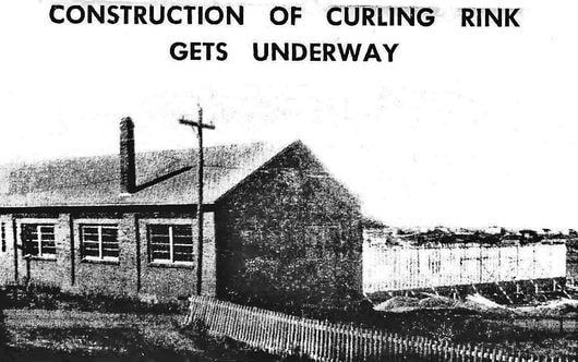
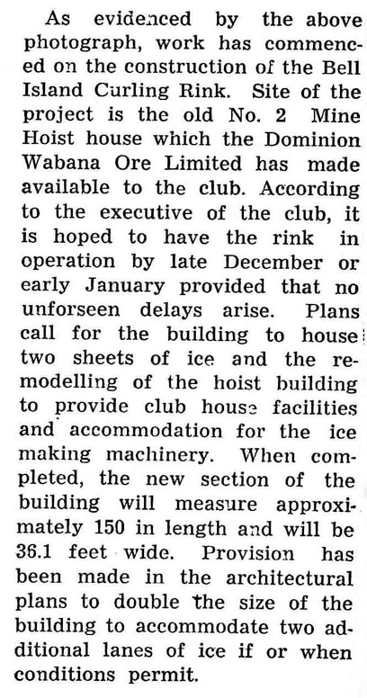
The October 1954 photo below is of the No. 2 Mine Hoist House with construction having been started on the north side of the building (as seen in the right of the picture) to accommodate a curling rink. The original building would house the clubhouse facilities and the ice-making machinery. Photo and story from the October 1954 Submarine Miner, p. 6.
|
|
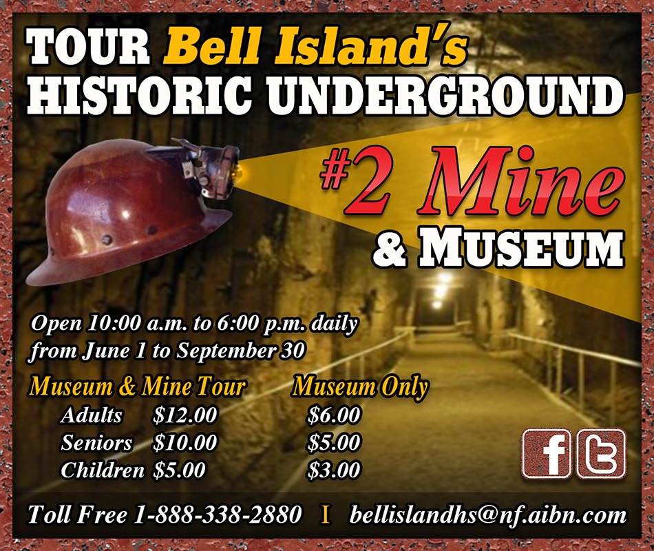
The Bell Island Heritage Society opened No. 2 Mine for tours in July 1998. The Bell Island Community Museum, constructed above the entrance to No. 2 Mine, was opened for visitors for the first time in the summer of 2000. Since that time, thousands of visitors visit the museum and take the mine tour each summer during the tourist season. Below is a 2019 advertisement for the museum and mine tour. Get more information, or contact them, via their Facebook page: "Bell Island No. 2 Mine Tour & Museum."