HISTORY
MINING HISTORY
MINING HISTORY
No. 3 MINE
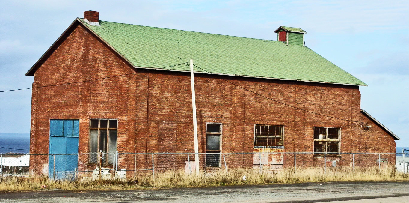
This page features pictures and brief descriptions of No. 3 Mine, the plant for which was located on the corner of Davidson Avenue and West Mines Road. No. 3 Mine was the last mine in operation on Bell Island when DOSCO ceased operations there on June 30, 1966. The only physical structure still standing on the site of No. 3 Mine Yard is the Hoist House. For photos of what No. 3 Mine Yard looked like at the time of the shutdown, see the Southey photos in Photo Gallery in the above menu.
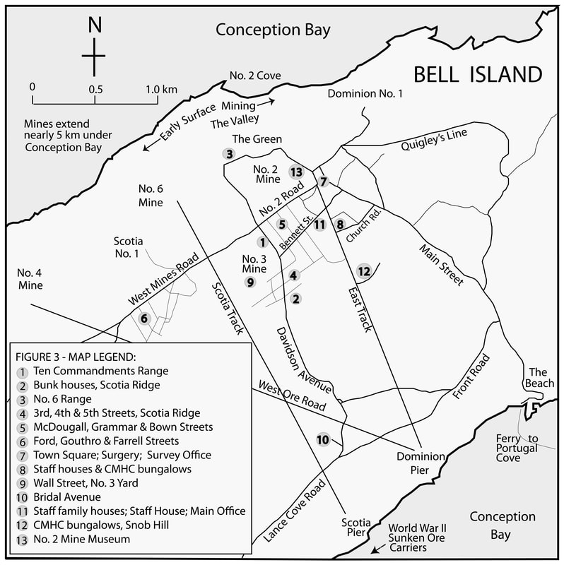
The map below shows the location of the plants for the four submarine mines, No. 2, No. 3, No. 4 and No. 6. No. 3 Mine Yard is seen at points 1 & 9. Map by Harvey Weir.
The map below shows the location of the plants for the four submarine mines, No. 2, No. 3, No. 4 and No. 6. No. 3 Mine Yard is seen at points 1 & 9. Map by Harvey Weir.
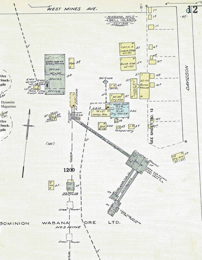
The diagram below is of No. 3 Mine Yard, July 1954. Source: "Wabana, Nfld." in "Insurance Plans of Towns in Newfoundland," Canadian Underwriters' Association, Toronto, 1954-1969.
The photo below is of No. 3 Hoist House in 2005. It is the only remaining physical structure in No. 3 Yard. This is the SW side as seen from the Arena parking lot looking North. Photo by Gail Weir, 2005.
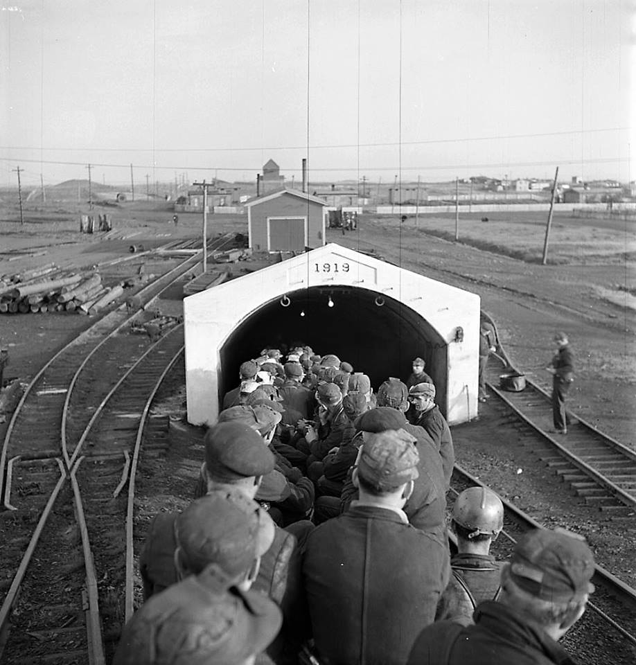
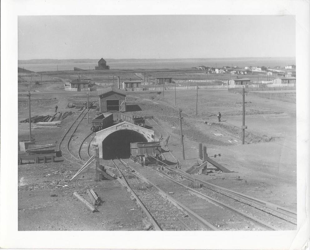
The photo below is of No. 3 Mine collar. No. 6 Mine deckhead can be seen directly north in the distance. Houses on The Green can been seen in the upper right side distance. The photo is titled "7 a.m. start of shift at No. 3 Mine." George Hunter photo, August 1949. Photo courtesy of Library & Archives Canada, photo #48380.
The photo below is similar to the one above with a better view of No. 6 Deckhead in the distance. The ore car at the collar is a 20-ton bottom-dump car. Photo courtesy of Ruth Archibald.
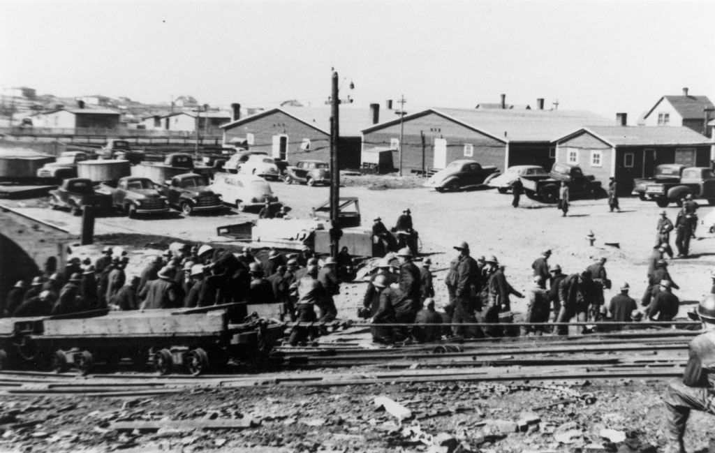
In the photo below, one group of miners is coming off the day shift while another prepares to board the man rake to begin their 2 and 1/4-mile journey down the Main Slope of No. 3 Mine, c.1954. Photo courtesy of The Rooms Provincial Archives.
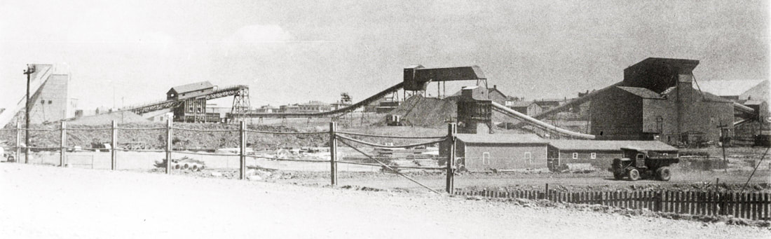
The photo below is from the cover of the Submarine Miner, V. 5, No. 1, January 1958 and shows some of the structures in No. 3 Yard at that time. On the left of the photo is the new Ore Conveyor System leaving No. 3 Slope Collar and entering the new No. 3 Deckhead Building. Just west of it is the old deckhead. From the new Deckhead Building, the ore was moved along to the Secondary Crushing Unit (partially out of sight behind the old deckhead). From the Secondary Crushing Unit, the ore went to the 7,000-ton Surge Pile (just to the right of the middle of the photo). A 42-inch reclaiming conveyor running underneath the Surge Pile forwarded the ore product to the Concentration Plant on the right of the picture. A 36-inch Float Conveyor discharged the Float product from the washing screens into a bin (the structure behind the buildings in the right foreground. From there it was trucked to waste.