HISTORY
PARSONSVILLE / FRESHWATER
by Gail Hussey-Weir
Created January 2022
by Gail Hussey-Weir
Created January 2022
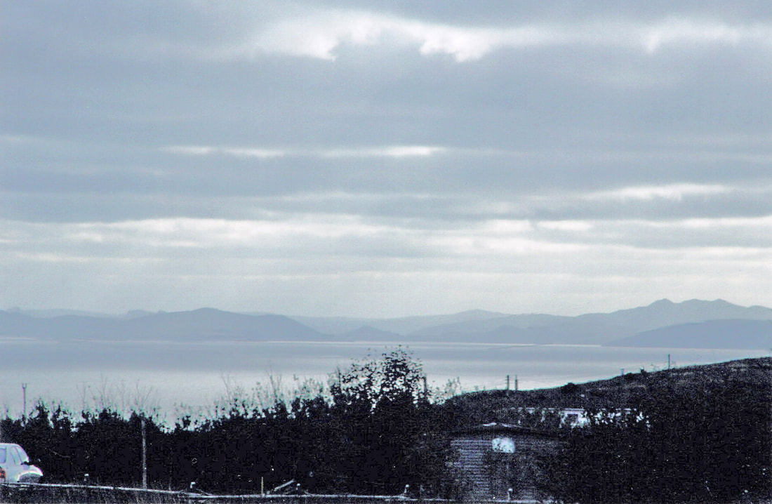
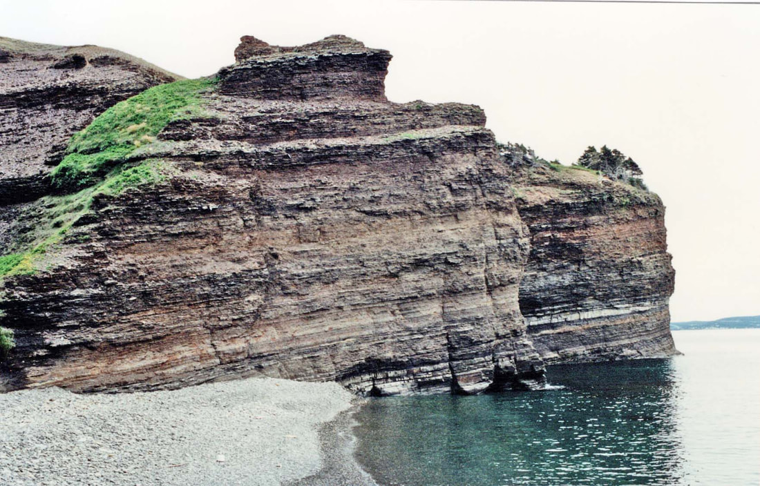
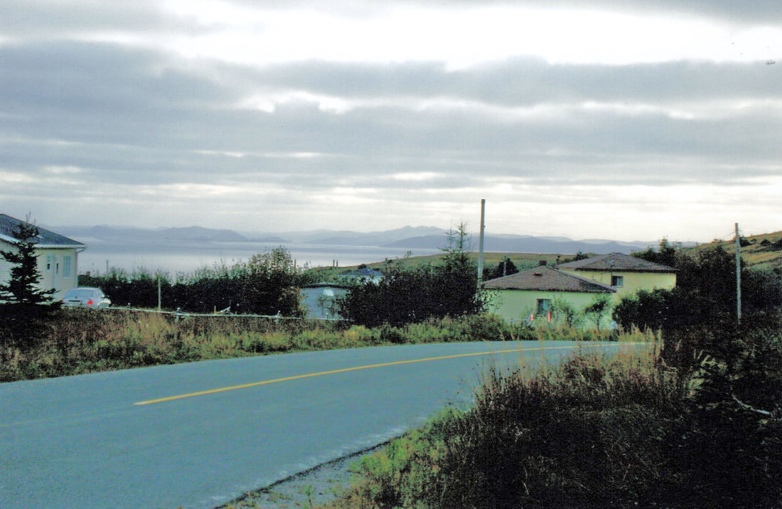
The photo below was taken at Parsonsville looking west towards the bottom of Conception Bay to the area of Holyrood- Avondale-Conception Harbour, in October 2008. Photo by Harvey Weir.
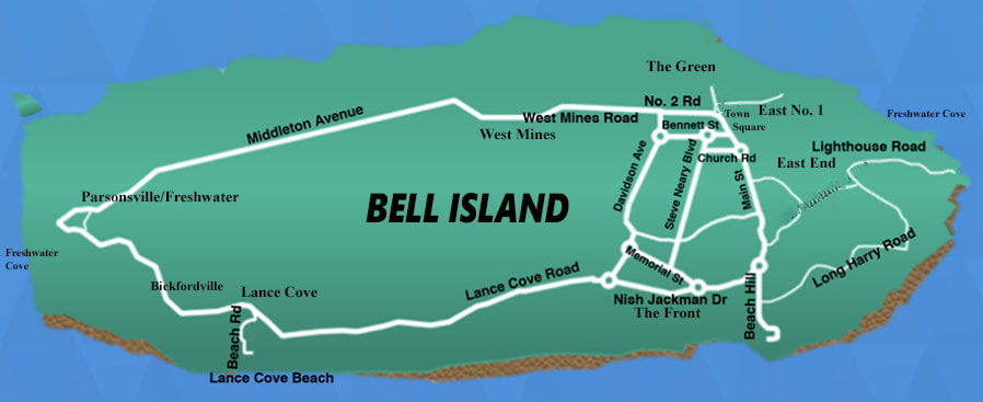
There are actually two coves on Bell Island that are named Freshwater, one at the west end for which the community now known as Parsonsville was first named, and the other at the east end of the Island. They were named that because at those coves fresh water flows over the cliffs onto the beach below where, in bygone times, ships would sometimes stop to replenish their fresh water supplies. This basic map of Bell Island is to show the location of Parsonsville/Freshwater (at the west end of the Island) in relation to other areas.
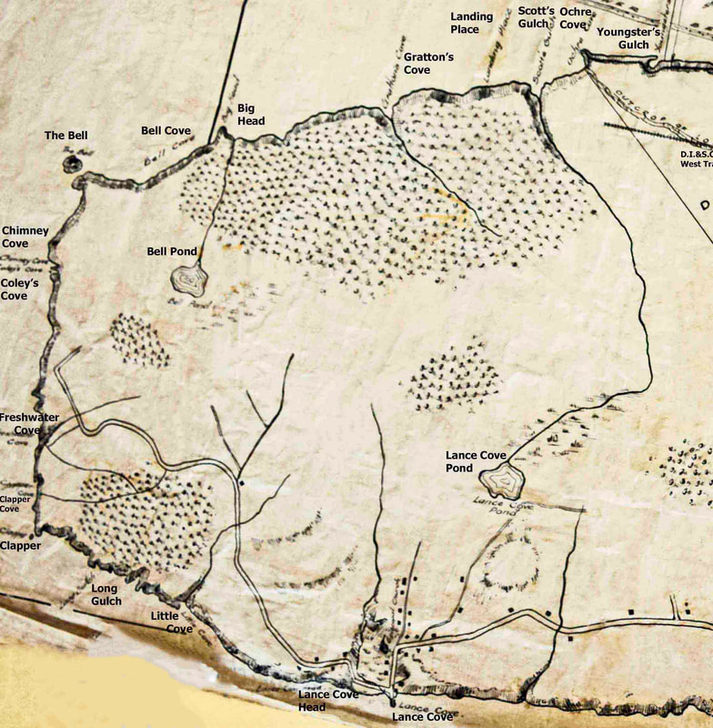
Below is part of a hand-drawn map entitled "Nova Scotia Steel and Coal Co. Ltd., New Glasgow, N.S. [N.S.S.&C.Co.] Plan of Wabana showing land and submarine mining areas." I have cropped the original to focus on the western end of Bell Island where Freshwater (now Parsonsville) is located. You can see the full map on this website in "Maps & Diagrams" in the dropdown menu under "History" in the menu at the top of this page. The map is undated, but going by mining structures shown in the full map, I am guessing c.1906-07. Freshwater is not marked as a community, but you can see Freshwater Cove on the left shoreline. The road through Lance Cove is represented as a double line. If you follow it northwest from Lance Cove Head, you pass through the area now known as Bickfordville and from there into the area of what is now Parsonsville. Small square dots along Lance Cove Road represent buildings. It is not known if this was meant to indicate all buildings at that time, but there is only one such dot in the Freshwater area. Source of map: The Rooms Provincial Archives, Bell Island Map Collection, MG19 B-58 334.
According to the Encyclopedia of Newfoundland and Labrador, Freshwater (now Parsonsville) at the west end of Bell Island became a settlement in 1856 when "a Mr. Parsons" moved there from Bryant's Cove, Conception Bay North. John W. Hammond, on page 64 of his 1978 book, The Beautiful Isles, has a family tree for the Parsons of Freshwater, showing the first generation as Joseph and Elenor (nee Yetman) from Bryant's Cove, married in 1824. You can see the Parsons family tree on the "People" page. Click on "P" in the dropdown menu under "People" above. When St. John's writer I.C. Morris visited Freshwater in 1906, he was told that the forebears of the 12 Parsons families living there at the time had come from Bryant's Cove about 50 years earlier.
Isaac C. Morris' Visit to Freshwater in 1906
Isaac C. Morris (1857-1937) operated a sail-making business in St. John's and served on the city Council. He was a public speaker and a prolific writer for the St. John's newspapers on the social and political issues of the day, and it was in this capacity that he became "one of the important people in Bell Island's history never to have lived there." There were no newspapers on Bell Island in the early years of the iron ore operations, and no newspaper correspondents living on Bell Island to report on all the mining and other activity going on there. Morris liked to travel outside St. John's on summer weekends and holidays, visiting communities and chatting with locals about their history and culture. He visited Bell Island on at least five occasions between 1897 and 1911 and reported in The Daily News on the mining activity and social life, and changes he had observed over that time period. Here is what Morris wrote about Freshwater and area after he visited Bell Island in early July 1906.
"At Bell Island, we visited what to us was new territory. With the mines, or Wabana, we are well acquainted; of Lance Cove we have also a good knowledge; but these do not constitute the entire locality. Some time ago, we learned of a settlement there called Freshwater, and during our recent visit we wandered along until it came into sight. We had been told that it was one of the prettiest parts of the Isle; hence our intense interest. We found the road to be a very good one, it being unusually wide and leading through a fine forest of spruce. When we beheld this forest, and remembered that in years gone by shipbuilding was extensively carried on at Lance Cove, we almost wondered why a little of it is not done there at present. The village of Freshwater is indeed a small one, and consists of some 12 families, most if not all of whom are of the same name: Parsons.
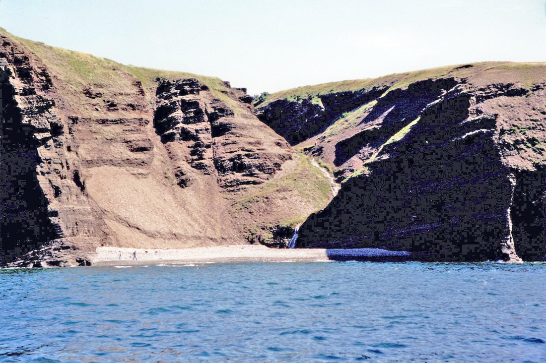
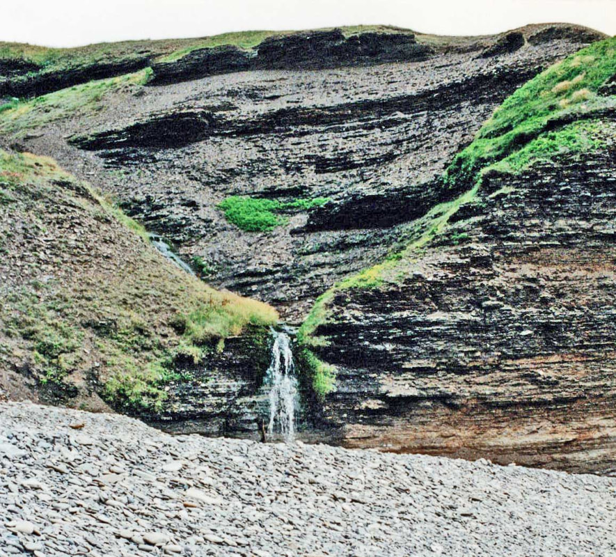
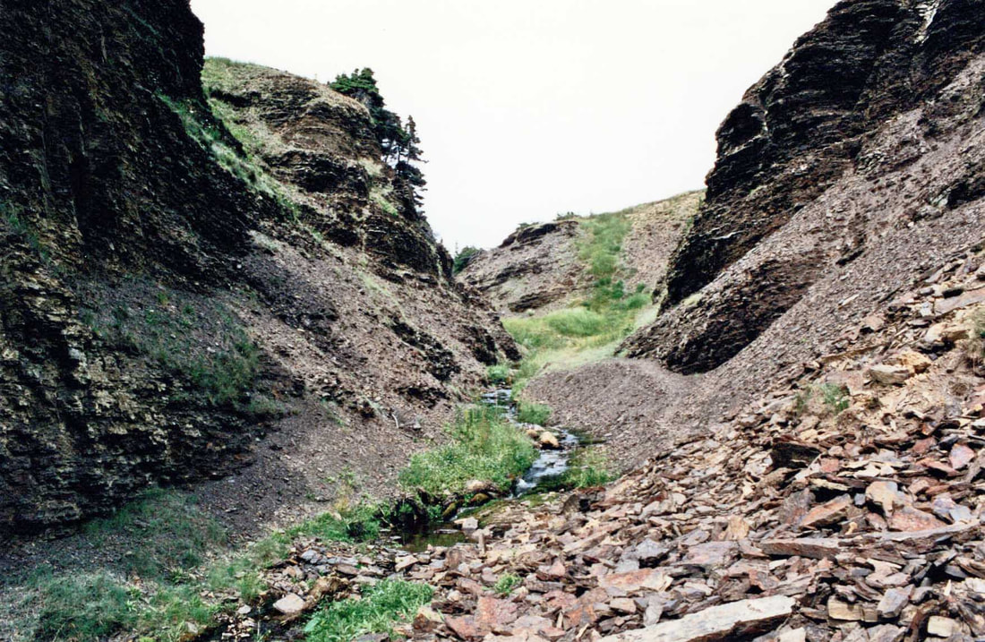
"A visitor in such an out-of-the-way-place is sort of a novelty; but we were soon quite at home in the house of Mr. Parsons. It being Saturday evening, the young men were all present, they having returned from their work at the mine some five miles distant. From Mr. Parsons himself we learned the history of the settlement of this remote part of the Island. His parents formerly lived at Bryant's Cove near Harbour Grace. About 50 years ago, they left that place and pitched their tent on that part of Bell Island which lay within sight of their door at Bryant's Cove. They landed in the cove, or gulch, called Freshwater and, climbing up the slope by the course of the river, they built their tilts and made themselves as snug as possible for the winter. Below are some photos of what Morris referred to as "the cove, or gulch, called Freshwater." These were taken in July and August 1995 by Harvey Weir. The first photo was taken from the water. The waterfall that gave the cove its name is just to the right of center flowing onto the beach. The "path" up from the beach is not a gentle slope. It is just to the left of the waterfall and curves to the right up the embankment and out of sight halfway up.
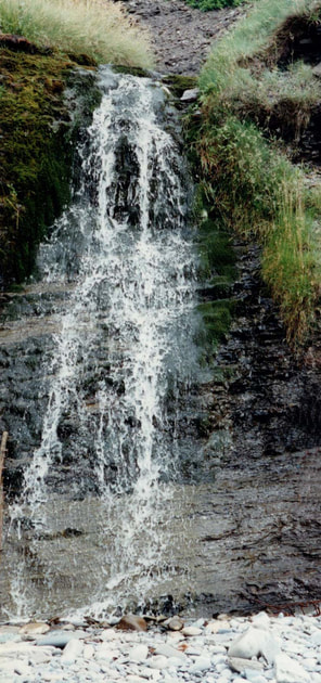
Below is a view of the waterfall from the beach.
The scene below is immediately to the right of the waterfall seen above and below.
A close-up of the waterfall, and the pretty stream part-way up the slope.
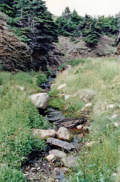
The gulch and stream part-way up the slope that the first settlers would have traversed to get to and from their fishing boats and homes.
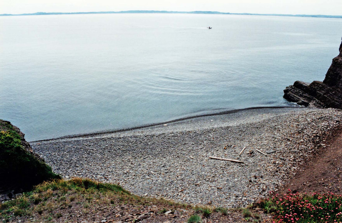
Looking down at the beach at Freshwater Cove from above.
Isaac C. Morris' account of his 1906 visit to Freshwater continued:
"The forest being abundant, they only needed to get their saw pits ready and, as soon as they could, the neat dwelling house took the place of the rough-hewn tilt. The isolation was extreme, and the loneliness intense, but the little band of colonists soon overcame their drawbacks. Little by little, they cleared the land, and soon they began to reap the reward of their industry. The ground yielded well and, by industry and integrity the fruits of independence became their heritage. They were cut off from the great world; cut off from the ministrations of the church, and had to do without many of the blessings that most of us enjoy. But their spiritual needs were not neglected. Bell Island has long been under the spiritual oversight of the Rev. Walter Smith of Portugal Cove and, in his visits to the Isle, he did not neglect even the out-of-the-way place of which we now write. The houses were kept well supplied with the scriptures and with the prayer book, also with an excellent manual of family readings and meditations. Thus the home-life of the settlers of Freshwater was brightened and, though so much to themselves, they none the less had the joy of that peace which so many of us in the more crowded city miss.
"In the course of events, the path became smoother, and with years came the younger families and the additional homesteads. A comfortable living has always been made, and now that the mines are in operation, the chances are all in favour of still better prospects. The mines are a boon to the rising generation and now, instead of having to seek afar for employment, it is found at their very doors. Of the different persons to whom I spoke, all spoke in praise of the benefit of the mines. A lad of 16 told me that he earned $1.20 a day, and another of 14 that he was getting 8 cents per hour. This, with the scarcity of men, which necessitates overtime, makes the monthly pay quite a snug item. All the young men of Freshwater are doing well at the mines, and with the splendid lands, and thickly wooded forests at their disposal, the outlook is greatly in their favour."
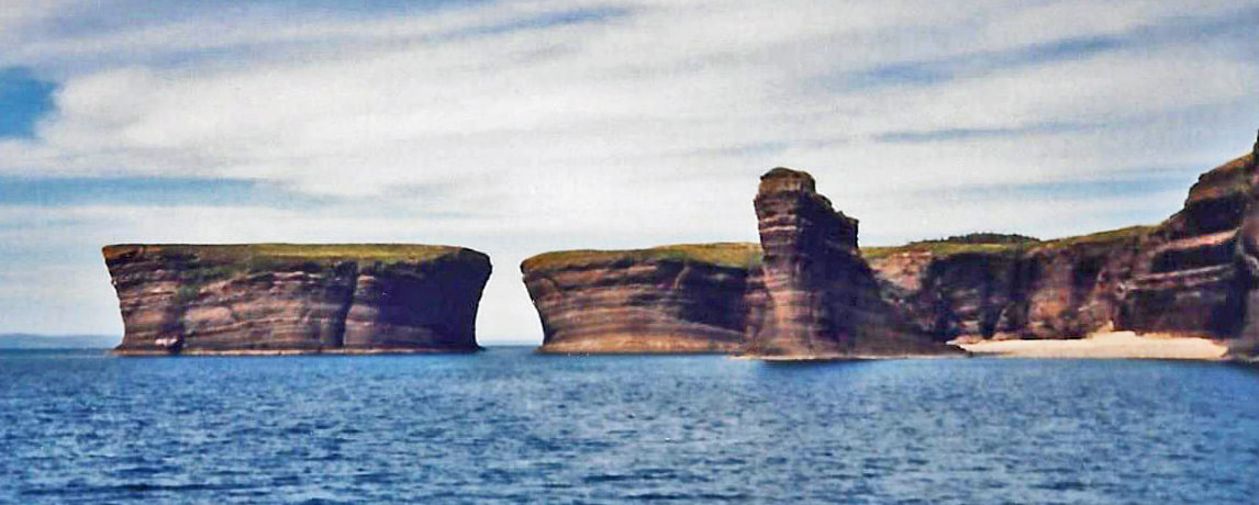
Morris next turned his attention to the nearby Bell Rock saying, "It is at this point of the Isle that the Bell is to be seen to advantage." He then went on to tell a daring tale of John Butler of Topsail climbing onto the Bell Rock at the west end of Bell Island. Addison Bown, in his "Newspaper History of Bell Island," introduced Morris' story of the scaling of the Bell Rock with a little commentary of his own: "The isolated Bell Rock at the north-western corner of the Island, which is as high as the Island itself and gives it its name, was conquered by John Butler of Topsail in an ingenious manner. It is separated from the Island by a chasm several hundred feet across. Around its base, the restless sea chafes unceasingly or dashes in spray against its smooth, sheer sides, which taper outward to form an inverted bell, whose summit is higher than the Island itself. Only once in recorded history has a human being set foot on the Bell Rock, where countless seabirds make their nests and rear their young in the security of that remote fastness. He was a brave man named John Butler of Topsail."
Morris did not say if he got the following account from the people he spoke with in Freshwater, or from some other source, neither did he give a date for this daring adventure, but it was probably around the turn of the century. In any event, here is his story of the Butlers and the Bell Rock:
The Butlers' Bell Rock Adventure
as told by Isaac C. Morris in 1906
as told by Isaac C. Morris in 1906
"To climb this rock is almost, if not entirely, an impossibility; but it has been done by one man at least. This was Mr. John Butler of Topsail. The means used by Mr. Butler were very risky, and only a man of strong nerve could accomplish such a feat. In company with his respected father and other members of the family, he sailed over from Topsail and climbed to the top of Bell Island proper. From that point, they fired a rocket, to which was attached a strong line; this was carried right over the chasm between the two heights, and further on across the top of the Bell Rock, and then it fell into the landwash below. A cable was then fastened to the line and well secured on the Bell Island side. The party then returned to their boat and rowed off to the beach at the base of the Bell Rock, and they hauled in on the line and secured it in such a manner as made it safe for a man to crawl across the cable on to the top of the Bell Rock. John Butler then returned to the Island and made his way hand over hand across the gulf, 200 feet above the water to the top of the Bell Rock. The object of this undertaking was to procure guano and test its market value." (Guano is the accumulated excrement of seabirds, which is a highly effective fertilizer with exceptionally high content of the nutrients essential to plant growth. In the 19th-century, guano trade was quite lucrative. Being farmers, the Butlers no doubt sought this fertilizer for their farms in Topsail, but they probably also hoped to sell any they did not need, if harvesting it proved to be a feasible task.) Morris concluded his story, "This feature of it was not a success, as the labor entailed in retrieving the guano was in excess of any reasonable figure."
Note: This Butler family of Topsail were the ones who filed claims to the iron ore beds on Bell Island in 1892, then leased their claims to the Nova Scotia company that started mining the iron ore in 1895, selling their claims to the that company in 1899.
Morris concluded his recounting of the visit to Freshwater with this observation:
"While walking near the village, our attention was aroused by the material used as a top dressing for the road. The moment we trod upon it, we felt that there was something more than ordinary gravel under our feet. From enquiry we learned that it possesses large mineral qualities and that upon that very day some English experts had been over the ground with the Rev. Father McGrath and had taken away several samples of this very material. All this tends to show that the mineral resources of Bell Island are very great, and that if developments continue, the place will yet become even a greater line of industry than the most enthusiastic of us have dreamed of. Having finished our enquiries, and having been kindly received by the people, we left for our lodgings at Wabana feeling that we have added to our knowledge of our country."
Population Makeup of Freshwater, 1874-1962
Freshwater did not appear as a separate community in a census until 1874 where it was referred to as "Fresh Water, Bell Isle." There were five families comprising a population of 35. Presumably, these were the five sons of Joseph and Elenor Parsons:
Joseph Jr. and wife Amy;
Edward and wife Hannah;
Thomas and wife Theresa;
John and wife Annie, and
George and wife Mary Ann.
It was not mentioned again in a census until 1911, when 88 residents were recorded. There were 106 residents of Freshwater in the 1921 Census, 80 of whom had the surname Parsons, while there was one George family and two Rees families. In 1935, there were 155 residents, 113 were Parsons, with four Rees families, one Dicks and one George family. In 1945, there were 128 residents of Freshwater named Parsons. Because the census area took in part of West Mines and also the area from Lance Cove to Freshwater that would previously have been included in Lance Cove and is now called Bickfordville, it is difficult to say for sure how many others lived in Freshwater itself, except perhaps for four Rees families, two George families, and one Dicks family. My best guess is that about 167 people actually lived in Freshwater in 1945.
McAlpine's 1898 Community Gazetteer describes Belle Isle as an island in Conception Bay in the District of St. John's East, containing three settlements: Beach, Lance Cove and Freshwater. Even though mining had started three years previously and hundreds of men commuted to the Island each week and lived in shacks near the mines in the area that would eventually be called "Wabana," they were not considered permanent residents, so were not included in the Directory for 1898, neither was the mines area considered a community for the Directory's purposes. No Scotia Company mine officials were listed and there was no mention of their staff house. 12 men with the name Parsons were listed; only one of those was described as a miner, the rest were all fishermen or farmers.
Freshwater has never been an incorporated community. A plebiscite was held in 1949 asking the people of Bell Island if they favoured the establishment of a town council. The Front, Lance Cove and Freshwater remained unincorporated, while the area surrounding the mines incorporated as the Town of Wabana in 1950. A few years later, The Front joined Wabana.
McAlpine's Directory for 1894 listed 11 men in Freshwater, all with the surname Parsons. Prior to the beginning of mining activity in 1894, the residents of Freshwater, like everyone who was then on Bell Island, fished for cod and herring, and practiced subsistence farming. Once the mining of iron ore started in 1895, most of the men began working in that industry, continuing to do some fishing and farming on the side. It was also noted in the 1911 Census that four men from Freshwater operated a sawmill that produced 100,000 "super feet" of sawn timber in 1910 that was valued at $1,700. Several mines were being driven underground and under Conception Bay at that time, so this timber may have been purchased by the mining companies for their use in that work. As time went by, mining became the main occupation on Bell Island, employing more and more men from all parts of Newfoundland and beyond as demand for Wabana iron ore increased. General stores and other businesses were established all over the Island, especially in the mining areas. Eventually, fishing and subsistence farming became less and less of a necessity as people were earning steady incomes from mining and had easy access to shops where they could purchase what they needed to feed their families.
In the 1955 List of Electors for Parsonsville (its official name since 1953), 40 men identified themselves as miners. Along with that, there were 2 clerks, 4 mechanics, 2 painters, 1 electrician and 4 trucker drivers, all of whom probably worked for DOSCO, bringing the total employed by the mining company to 53. There were also 6 pensioners and a secretary, who most likely also worked for DOSCO, so about 60 residents on DOSCO's payroll. The community also had a postmistress, a tavernkeeper, 4 teachers, 2 shopkeepers, 53 housewives and 1 retired lady.
Many of the men from Parsonsville would have worked in No. 4 Mine as it was the most westerly mine and the closest for them to walk to. The closure of No. 4 Mine in January of 1962 had a huge impact on the population of Parsonsville and led to the news item in the Daily News of August 2, 1962 with the headline:
48 People Left Parsonsville
"Forty-eight residents moved from the little community of Parsonsville on the west end of the Island during the present summer [1962]. These people, members of families affected by a major lay-off in the DOSCO mining operations here, are now residing in Ontario where they found employment."
Down through the years, there were several small general stores serving the community, but no business center as such. Two people were listed as "storekeepers" in the 1955 List of Electors: Alexander Parsons, Jr. and Lucy Parsons.
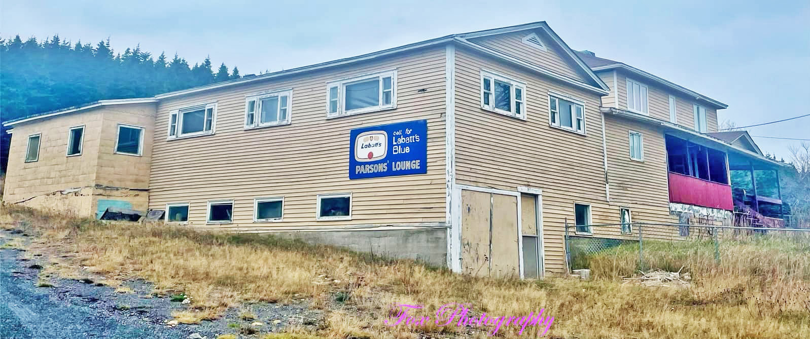
The 2019 photo below by Cindy Fox is of the former Parsons' Lounge in Parsonsville. Edward (Ned) and Martha Parsons ran a hotel on Theatre Avenue, The Green from 1931 to 1949. By October 1949, they had moved to Parsonsville, where they were operating the "Middleton Inn," which also included a tavern, dance hall and restaurant/snack bar. Besides the regular Saturday night dances to live music, it became a popular venue for wedding receptions and other group celebrations. The snack bar was also an attraction for local youngsters. At some point the name of the the business was changed to "Parsons' Lounge," perhaps when it was taken over by the Parsons' son, Herb and his wife, Mabel. In the 1990s, their daughter, Terry Lynn Parsons, took over and ran it until about 2017. Read a bio of Edward and Martha Parsons on this website. Click on "P" in the dropdown menu under "People" in the menu at the top of this page.
The 2019 photo below by Cindy Fox is of the former Parsons' Lounge in Parsonsville. Edward (Ned) and Martha Parsons ran a hotel on Theatre Avenue, The Green from 1931 to 1949. By October 1949, they had moved to Parsonsville, where they were operating the "Middleton Inn," which also included a tavern, dance hall and restaurant/snack bar. Besides the regular Saturday night dances to live music, it became a popular venue for wedding receptions and other group celebrations. The snack bar was also an attraction for local youngsters. At some point the name of the the business was changed to "Parsons' Lounge," perhaps when it was taken over by the Parsons' son, Herb and his wife, Mabel. In the 1990s, their daughter, Terry Lynn Parsons, took over and ran it until about 2017. Read a bio of Edward and Martha Parsons on this website. Click on "P" in the dropdown menu under "People" in the menu at the top of this page.
Roads, Water & Sewerage, Other Amenities
Roads
Until mining began, roads as we know them today did not exist on Bell Island. In 1840, the first road was completed on Bell Island, but it was not much more than a muddy path that a horse and cart could be driven on, ran along the Front from the top of what is now Beach Hill along to Nish Jackman Drive, which was called "Old Front Road" before the name was changed sometime in the 1970s. This road continued on to Lance Cove and from there to Freshwater, where any semblance of a road ended. The men from Freshwater working in the mines would walk along a path to the north side of the Island to get to and from work.
In 1907, public roads on Bell Island were reported to be knee-deep in mud. On June 29, 1909, a Road Board was appointed for Bell Island proper, Lance Cove and Freshwater, with representatives from each area to oversee the maintenance of the roads. Government help with roads was slow and in 1910 the local elected representative reported to the House of Assembly that roads on Bell Island were mere swamps in wet weather.
By 1922, the post-war depression had begun. Ore was being stock-piled due to lack of markets and the mines alternated between full shut-downs and shortened work weeks. There was no employment insurance in those days. Those who received government relief payments had to work for it, all for the princely sum of one dollar a day. The building of the road from West Mines to Freshwater was started as a make-work program for out-of-work miners. The term, "Whack," was a colloquialism for "dole" or work done for welfare payments and, thus, the road became known locally as "The Whack Road." This nickname continued to be used by locals into the 1950s and 60s. Work on the road began on March 25, 1922. The distance to Freshwater from the starting point at the Dominion Company's West Barn was three and a half miles and the road was 18 feet wide. A ditch was dug along each side of the road totaling a distance of seven miles through snow, frozen ground and swamp. All the work was done with pick and shovel by the strong-backed men whose normal job was shoveling iron ore all day, six days a week, so these men knew hard work. The main difference was that they were now doing it in all manner of weather, sometimes having to shovel snow and break ice first before they could get to the road work. It is interesting to note that it was the intention at that time to also construct a branch road to Lance Cove, but this never came to fruition. The Whack Road was under construction for six years and finally completed by the Highroads Commission after a special government allocation came through, along with the regular road grant in July 1928. 140 men were engaged that summer under the direction of Peter Murphy, and finished the job at the end of August. On September 12, 1928, the Governor of Newfoundland, Sir John Middleton, officially opened the highway now known as Middleton Avenue by cutting a ribbon at the Freshwater end in the presence of the district member, J.M. Greene, MHA, and local officials. "It was a notable event in the history of local communications for it meant that for the first time a complete circuit of the Island was possible by road. Up to then, Freshwater could only be reached by way of Lance Cove. Now, with the opening of the new road from West Mines to Freshwater, the isolation of the western section of Bell Island was at an end."
Main roads at Lance Cove, Bickfordville and Parsonsville were not paved until 1972.
Here are the roads that Elections Newfoundand & Labrador lists for Parsonsville in 2021:
The community of Parsonsville including Belle Road; Lil Fitzpatrick's Road; Middleton Avenue; Miller's Road; Parson's Road; and River Path Road.
The communities of Bickfordville, Lance Cove and Parsonsville share one Polling Station (No. 34). There was a total of 285 registered electors for that Polling Station in 2021.
Postal Service
It is not clear when Freshwater first got a post office, but Harvey Parsons was Postmaster at Freshwater in 1929. Chatfield Parsons was the Postmistress in 1955.
Electric Power
On October 27, 1932, the Wabana Light and Power Company began construction of a light line to Freshwater at the west end of the Island and completed it on November 11. The line was 1.6 miles long. 23 families were supplied.
Water & Sewerage
In 1973, water and sewerage lines were installed in Parsonsville.
The photo below was taken at Parsonsville looking west towards the bottom of Conception Bay to the area of Holyrood- Avondale-Conception Harbour, in October 2008. Photo by Harvey Weir.
Church and School
There were no churches in Freshwater. Residents travelled to Lance Cove to attend St. Mary's Anglican Church and, for the most part, were buried in Lance Cove as well. Here are some excerpts from Canon Smith's diary (courtesy of John W. Hammond, The Beautiful Isles, pp. 18-19) regarding his visits to minister to the people of Freshwater in 1887-1890:
March 6, 1887:
"Rather stormy, very cold. Holy Communion at Belle Isle Beach. Frank Normore drove me [horse and sleigh perhaps] to Lance Cove. Called at Clements on the way. Matins and Holy Communion, dined with Mrs. Clements. At 4 o'clock, I churched Mrs. Solomon Rees and baptised her child. At 5:30, I churched Mrs. John Parsons [presumably in Freshwater]..."
October 16, 1887:
"Beautiful day. After morning Holy Communion, John Bennett drove Mary and I to Lance Cove...George Parsons drove us to Freshwater, where we held a cottage service and had private communion with Mrs. Elenor (Yetman) Parsons."
November 7th and 8th, 1890:
"I went to Belle Isle with Mr. Jackman; then walked to Lance Cove. Walked to Freshwater. Cottage service at John Parsons."
The first school at Freshwater was opened in a room in the home of Mr. Jacob Parsons. Unfortunately, no years of operation are given for this school. About 1890, the first regular school was built on a piece of land donated by Mr. Norman Parsons' father. This school was in existence for some 25 years. At the time of the 1911 Census, the one-room Church of England school at Freshwater employed one female teacher and accommodated 24 pupils. Around 1916, St. Stephen's School was erected as a one-room school. It was being enlarged in the spring of 1938. Presumably, this was the year that it became a two-room school. By 1944, when Joseph Frye became the Principal at St. Stephen's, it was a 2-room school with grades One to Eleven. In the late 1940s, it was enlarged with the addition of a third classroom, and a teacher's residence was built.
In the Foreword of the June 1953 Academician, the name of the Anglican Academy yearbook at that time, Rev. W.G. Legge noted, amongst other things, that "Individual High School pupils have been coming from Lance Cove and Freshwater schools for seven or eight years...If our numbers continue to increase in all areas, and our winters continue to get milder, we may eventually bring all pupils above Grade 6 from everywhere to the Academy from where they would go on to the Regional High School for Grades 9, 10 and 11. The Government has shown its interest in this plan of centralization by increasing the building grant in this year's Budget on condition that part of it be spent to erect Regional High Schools."
This hope for a regional high school came to fruition in 1957, so that grades taught at St. Stephen's in 1957-58 ranged from One to Eight; the enrolment was 74 pupils. Space was so tight, however, that Principal Frye reported the following year, "Our Christmas program this year was a bit different from other years. Because of lack of space, we were obliged to omit the entertainment part of our program. I'm sure the parents of all our pupils can appreciate the difficulty of trying to accommodate more than a hundred children and their parents in one classroom and then have the pupils perform for them without even the benefit of a stage." [It seems from the Principal's report that space that had previously been used as an auditorium was now being used as classroom space.]
As noted above, several Parsonsville families left for work in Ontario after No. 4 Mine closed in 1962. However, families from other areas of Bell Island purchased their houses, so there was actually a slight increase in enrolment in 1963, and there were now three teachers. Kindergarten for five-year-olds was offered for the first time at St. Stephen's in 1965. As well, a branch of the girls "Junior Auxiliary" was organized for the first time at the school and had 25 members from Freshwater and Lance Cove schools.
At the present time, I do not know exactly when St. Stephen's School closed. It was still operating when the Wabana Mines were closed for good at the end of the 1966 school year. Thousands of Bell Islanders moved to the Canadian mainland for other work over the next few years, causing drastic reductions in the school enrolment. St. Mary's School in Lance Cove seems to have closed at the end of the 1967 school year, and St. Stephen's probably closed at that time as well. A regular school bus service for the Island's school children came onstream about this time. Just a few years later, in 1969, Protestant school boards on the Avalon were integrated under the name Avalon Consolidated School Board, that took in Bell Island's United, Salvation Army and Anglican schools. For a number of years in the 1970s, Protestant children attended St. Augustine's for Kindergarten to Grade 3, then Jackson Memorial School for Grades 4-6, then returned to St. Augustine's for Grade 7 before moving on to St. Boniface Regional High School for Grades 8-11.
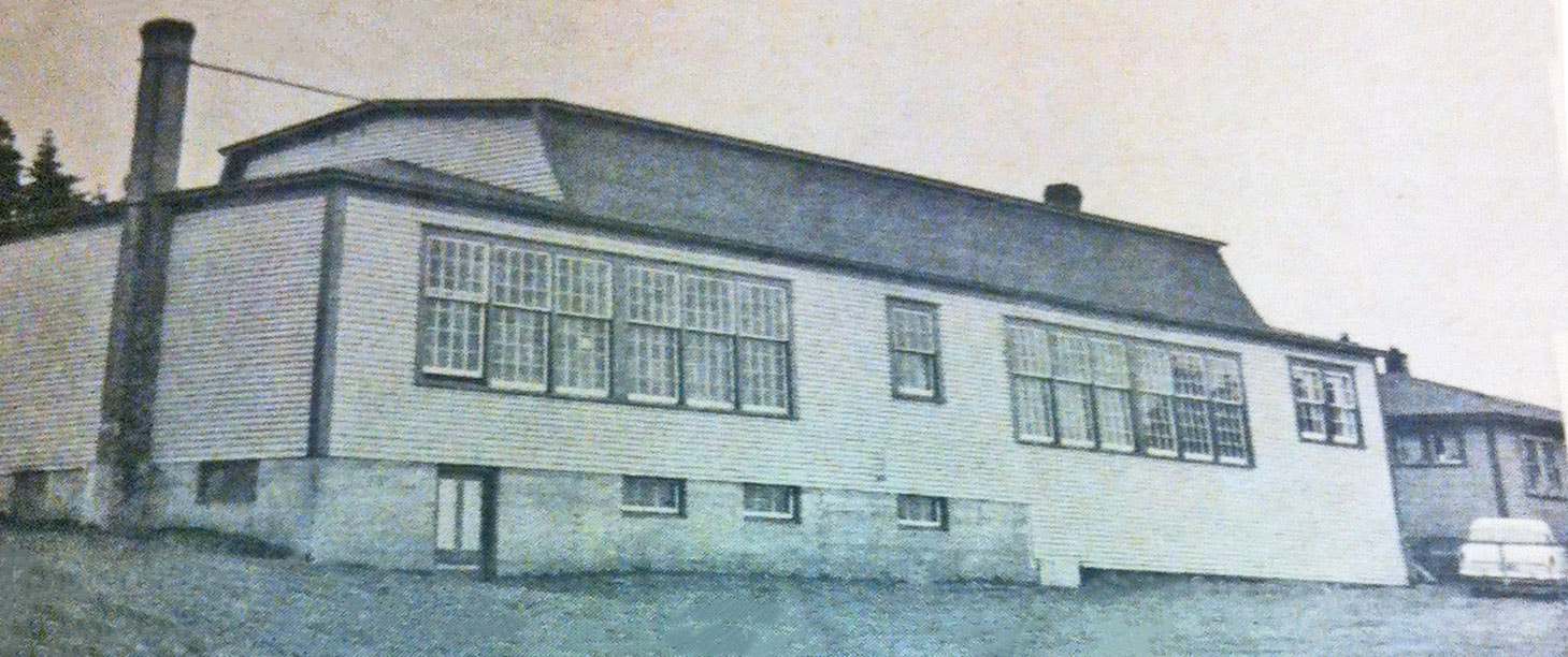
The photo below is of St. Stephen's School from the 1959 Anglican schools yearbook, Focus, p. 57.
|
To read more about St. Stephen's School, click the button on the right >>>
|
The Name Freshwater becomes Parsonsville
The name of the community of Freshwater was officially changed to Parsonsville by the Federal Government's Post Office Department in 1953. This was probably done to distinguish the community from the many other communities throughout Newfoundland with that name. The name change was mentioned in an article in the Daily News of December 3, 1953, p. 6. (In the same article, it was noted that "Wabana" was now the name to be used for mail that had previously been addressed to "Bell Island Mines.") Residents of Freshwater seemed hesitant to use the new name, however, as a look at the 1959 Telephone Directory shows that only one customer named Parsons identified his address as Parsonsville. All other Parsons in that community gave their address as Freshwater. This continued until 1963 when all of the Parsons families in the community gave their address as Freshwater. Gradually, throughout the 1970s and 80s, the name Parsonsville came into more common usage, but at least half the residents still were identifying their community as Freshwater through those decades.
Sources: Elections Newfoundland & Labrador, 2021 Provincial General Elections Report, p. 100 (website accessed October 28, 2022); Encyclopedia of Newfoundland & Labrador, V. 2, p. 419; Anglican school yearbooks; Department of Social Services and Rehabilitation Annual Reports, 1972 & 1973; Addison Bown, "Newspaper History of Bell Island," 1922, p. 66 & 1929, p. 28; Daily News, Dec. 3, 1953, p. 6; List of Electors, 1955; Census; Vital Statistics.
