HISTORY
MINING HISTORY
MINING HISTORY
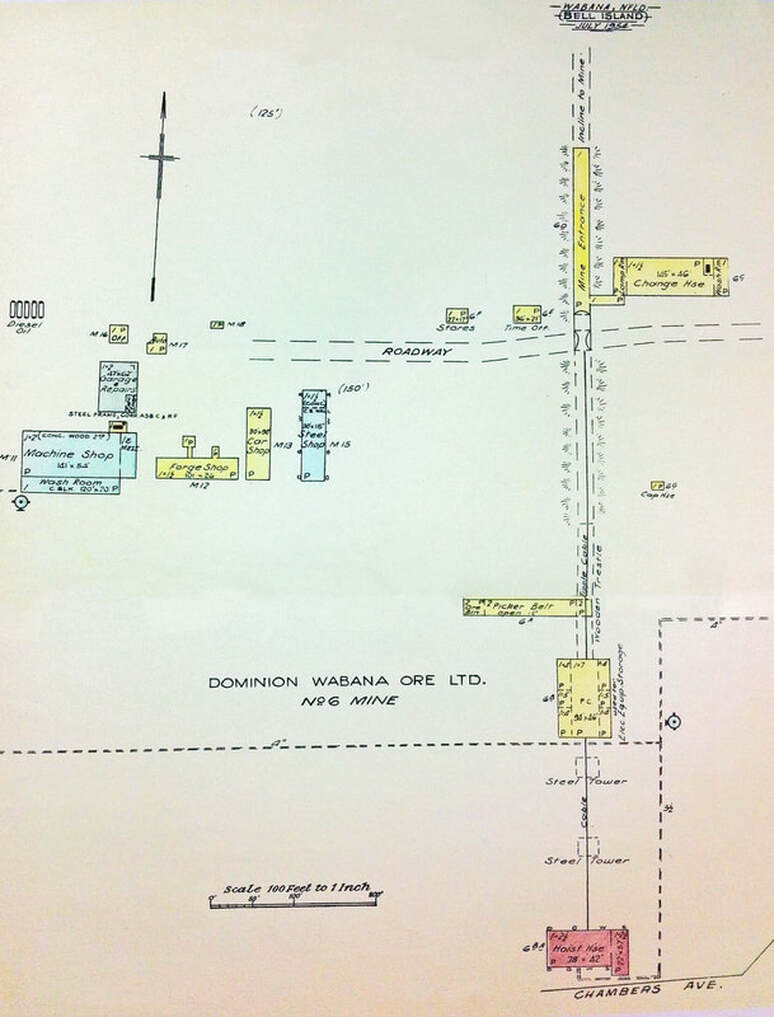
No. 6 MINE
This page features pictures and brief descriptions of No. 6 Mine, the plant for which was located on the north side of Bell Island at the west of The Green and directly north of No. 3 Mine.
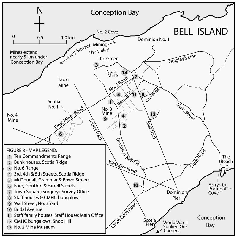
The map below shows the location of the plants for the four submarine mines, No. 2, No. 3, No. 4 and No. 6. No. 6 Mine Yard is seen at the northern terminus of Scotia Track. Map by Harvey Weir.
The map below shows the location of the plants for the four submarine mines, No. 2, No. 3, No. 4 and No. 6. No. 6 Mine Yard is seen at the northern terminus of Scotia Track. Map by Harvey Weir.
The diagram below is of No. 6 Mine Yard, July 1954. Source: "Wabana, Nfld." in "Insurance Plans of Towns in Newfoundland," Canadian Underwriters' Association, Toronto, 1954-1969.